
Our Road Density map layer visually displays the density/concentration of roads out West to help you find the sweet spot when e-scouting and hunt planning
A view of the GOHUNT Road Density layer on a computer.
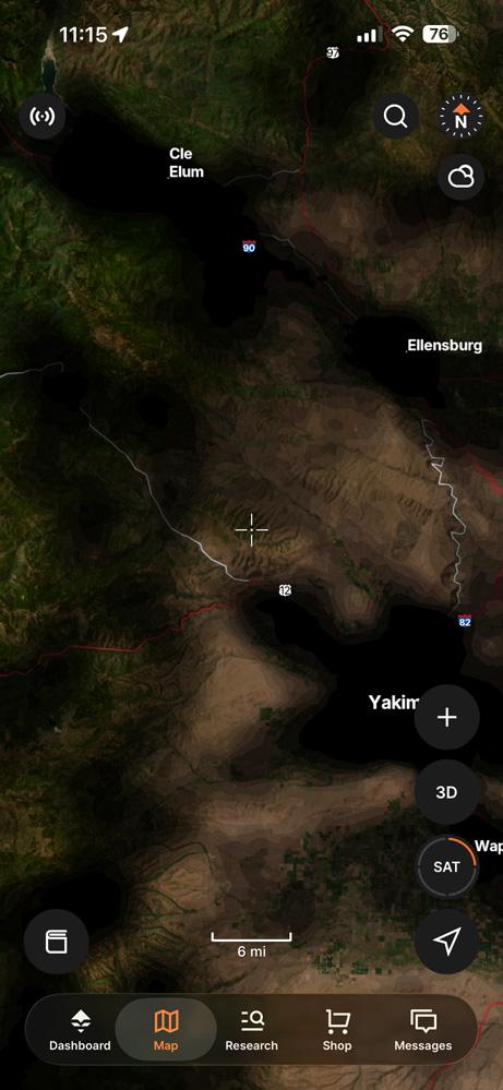
A view of the GOHUNT Road Density layer on the mobile app.
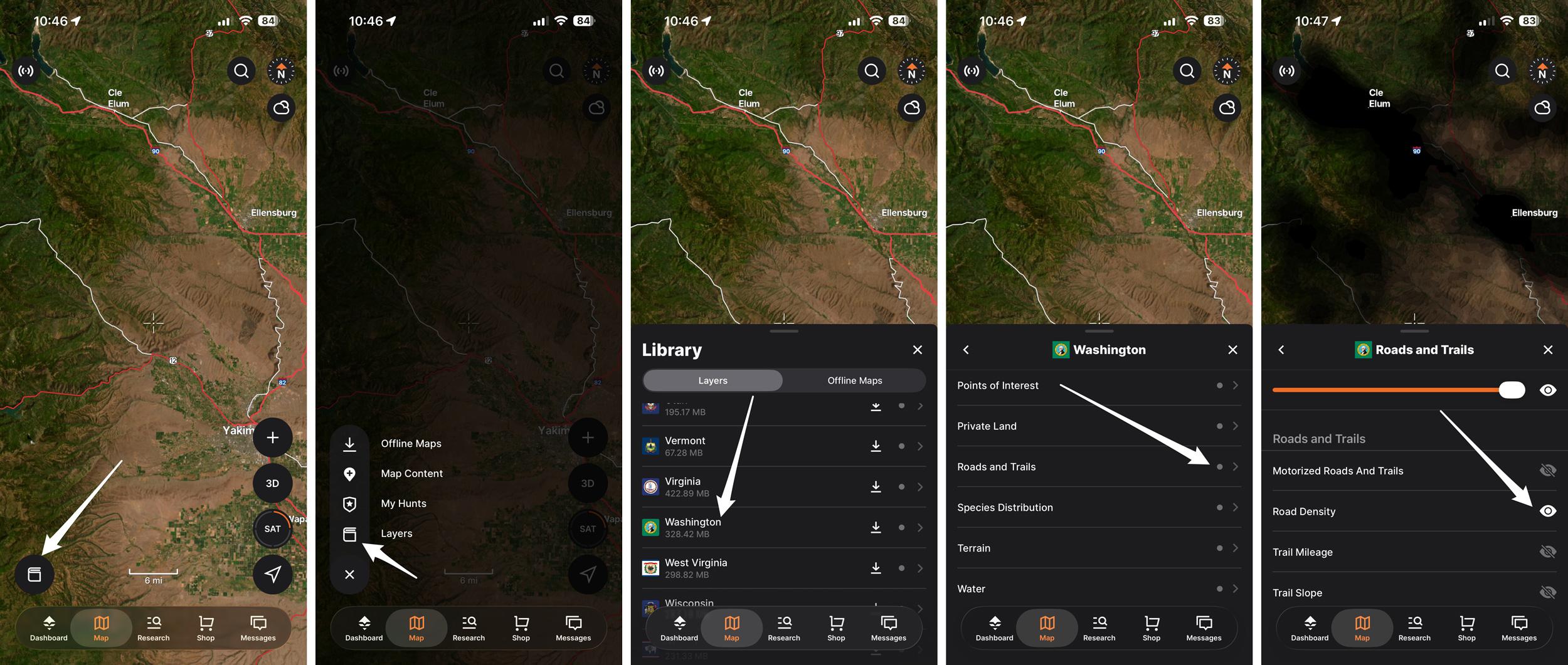
How to access our Road Density layer on the GOHUNT mobile app.
GOHUNT Road Density map layer example, showing satellite and topographic views.
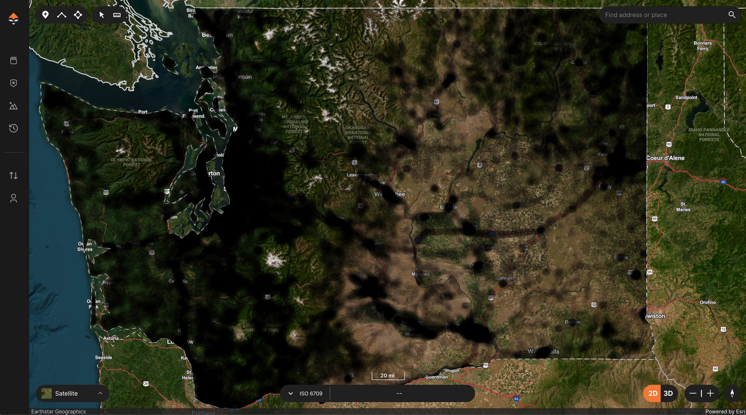
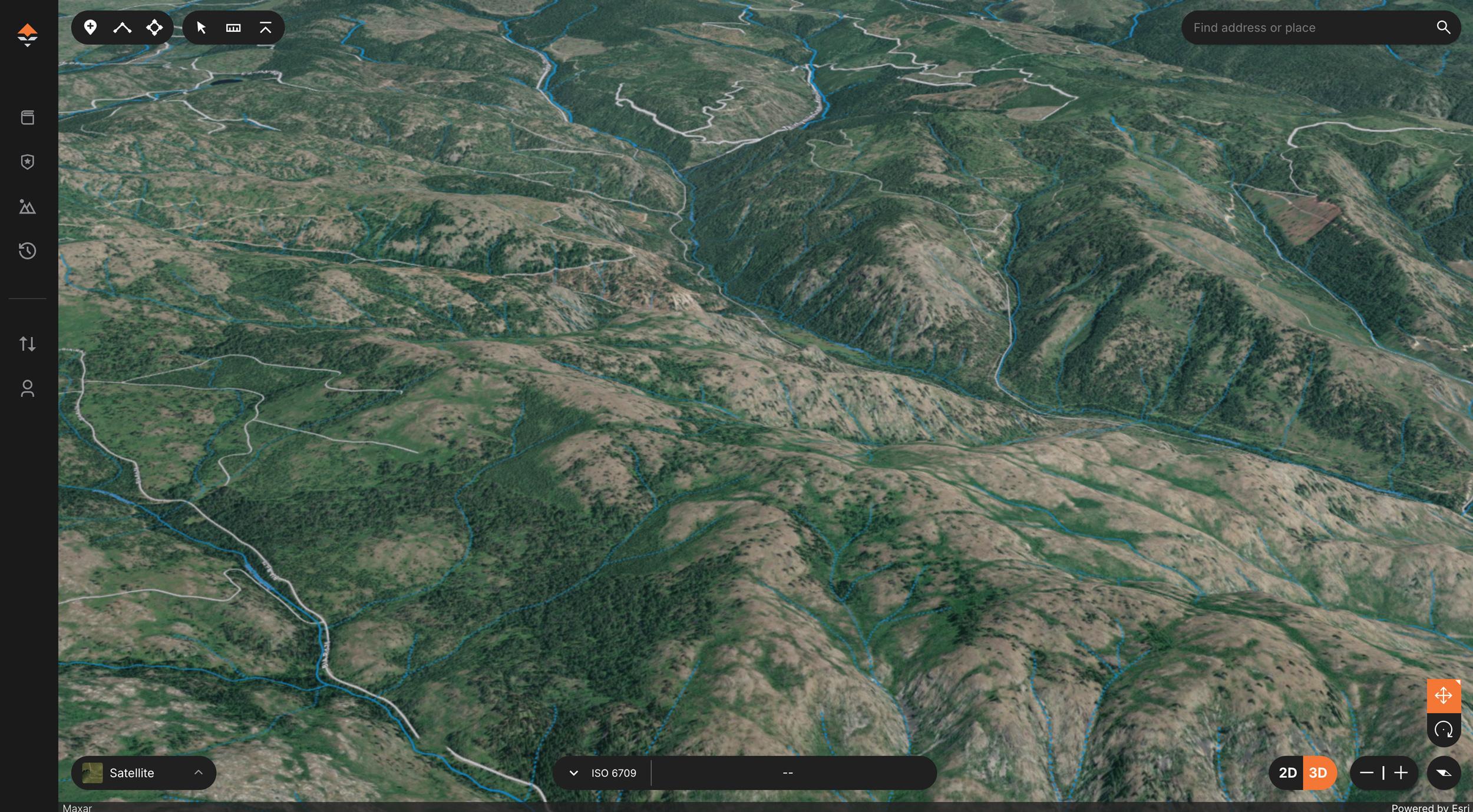
GOHUNT Road Density layer at state level view for big picture research.
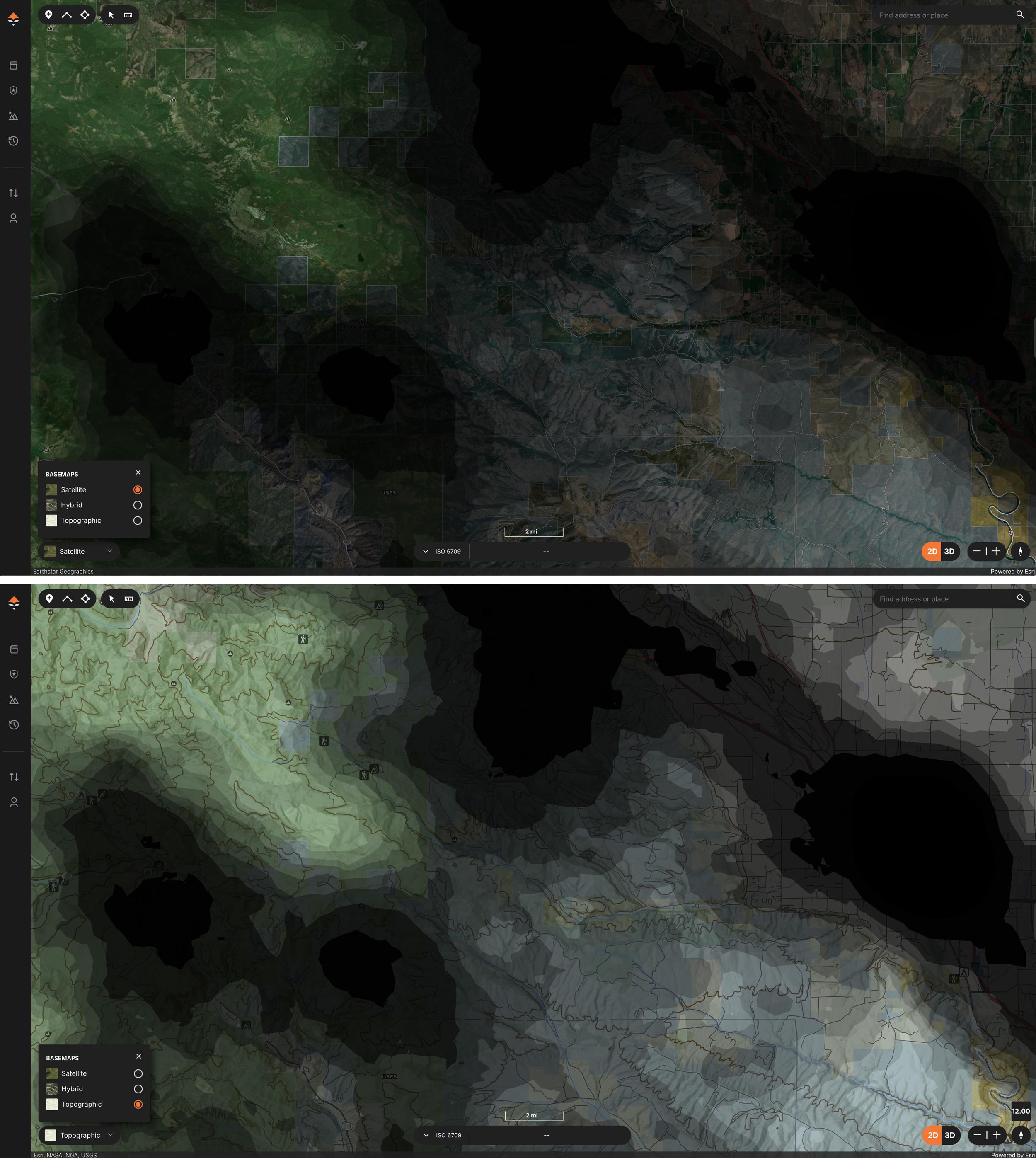
Road Density layer comparison between a satellite map with public land and a topographic map with public land.
When it comes to e-scouting for western big game hunting, there’s one thing I’ve learned over the years: solitude equals opportunity. That’s why I love our Road Density Layer on GOHUNT Maps.
This is another very powerful tool, and I believe the Road Density layer is perfect for those who enjoy getting away from pressure and into more animals.
Whether you're chasing high-country mule deer, bugling bull elk in thick timber, or hunting antelope on the plains, I feel like I have a better hunt when I find ways to get away from the crowds. Roads mean access, and access brings people. Our Road Density layer visually displays the density/concentration of roads, color-coded for clarity.
You’ll notice our Road Density layer is a little different than the normal “roadless layer,” and easier to use when e-scouting for your next hunt.
Our approach to this layer is more intuitive for hunters by tackling it from the road density side, rather than from a roadless area perspective, due to the fact that there are so few true "roadless areas" in the West.
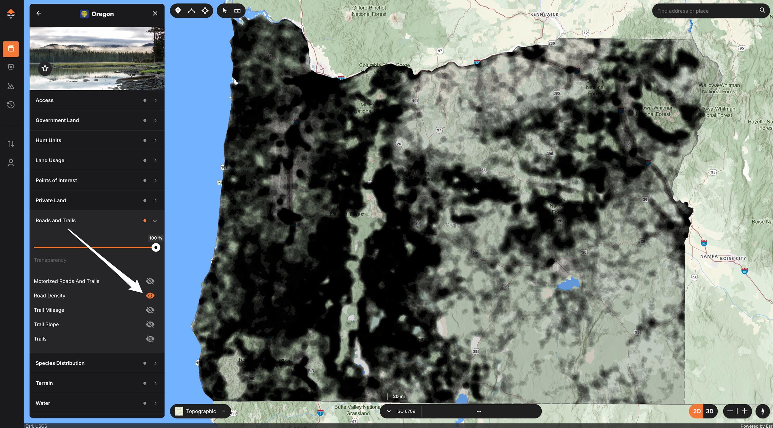
Basically, we took the number of roads per square kilometer and converted the data into a gradient scale. When using our Road Density layer, areas with high road density show up as a dark black color, while areas with low road density show up as light gray or even clear in color. In seconds, you can pinpoint where other hunters are likely to be—and where they’re not.
To calculate our layer, we included all motorized roads (everything from interstate highways all the way down to dirt bike trails) and used that in our calculations, so you truly get more than just roads; you even get things that might be a small motorized trail.
This isn’t just guesswork. It’s GIS-calculated data that lets you see the hidden seams between pressure and seclusion, giving you the edge when planning your hunt based on what you’re looking for. Do you want to find those pockets where people are less likely to put in the effort to hike into? This is your “roadmap” per se. And instantly, you’ll see places that are lacking roads, and areas that are heavily roaded.
A quick example of what the colors mean:
Our Road Density layer is currently available on the core western states: Arizona, California, Colorado, Idaho, Montana, Nevada, New Mexico, Oregon, Utah, Washington, and Wyoming.
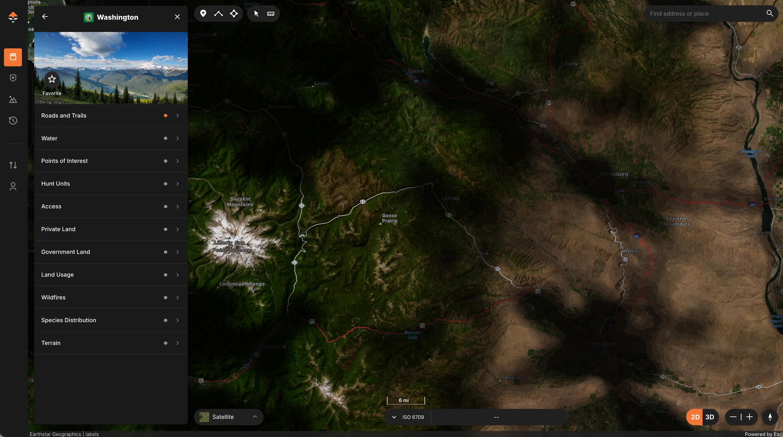
When e-scouting on the web version of GOHUNT Maps, you can find our Road Density layer under the "Roads and Trails" section of each Western state. Turn it on like you would any other layer, and you'll have access to this layer when you hit the right zoom level. You’ll notice certain areas get a black gradient applied to them.
You can also access the Road Density layer on our GOHUNT mobile app.
With the GOHUNT app open, tap on Map > select the left menu button > select Layers > tap a state > scroll to Roads and Trails > turn on Road Density. Note: This layer will also be downloadable for use in the field when cell service is unavailable and can be downloaded as part of your state sections on GOHUNT Maps. This can be particularly useful when you need to create a new backup plan.
You can also adjust the layer's transparency to make it more transparent, allowing you to see through it.
If you're having a hard time seeing the color gradients of the Road Density layer, turn on our GOHUNT Topographic layer basemap.
Looking for places away from roads? Zoom out to see the big picture of an entire state or unit, then slowly zoom in and look for pockets or areas that don’t have much black shading from the Road Density layer. These low-density road areas are your golden nuggets—terrain that’s harder to access, and could be where elk and deer tend to move into once the pressure cranks up.
Now, zoom in much further and really start examining the areas the Road Density layer reveals. If you’re someone who is looking to fully get away from people, you can find those areas more quickly by using our Road Density layer.
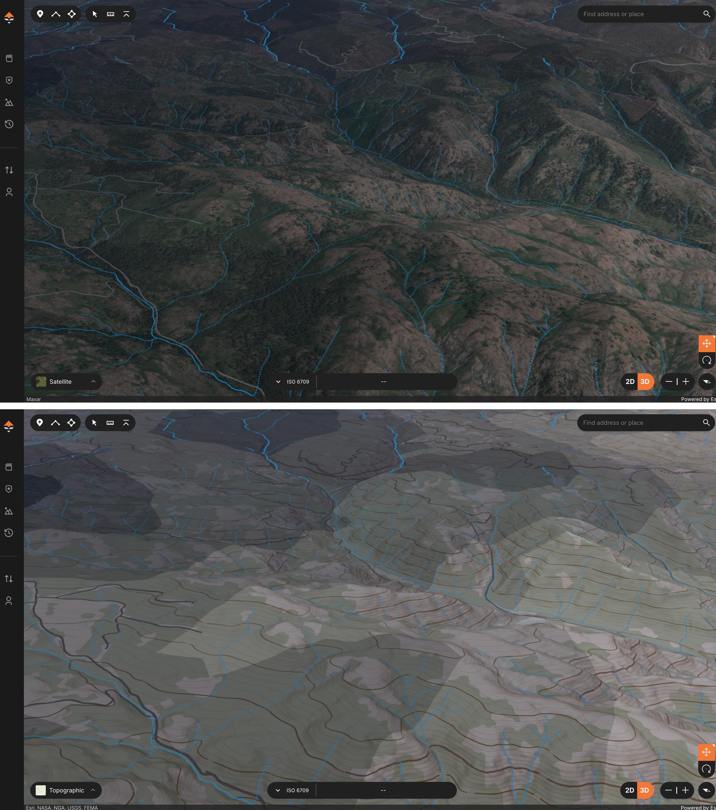
Next, overlay layers with the Road Density layer, such as public/private land, wildfires, migration, and elevation bands. By combining all these layers and analyzing the terrain in 3D, you paint the perfect picture for cracking the puzzle of elk and mule deer hunting.
Example one:
The area above is displayed with the Road Density layer, stacked on top of the public land layer, and overlaid on the satellite basemap. The second image is the Road Density layer stacked with the public land layer on our custom GOHUNT Topographical map. Both examples are also in 3D.
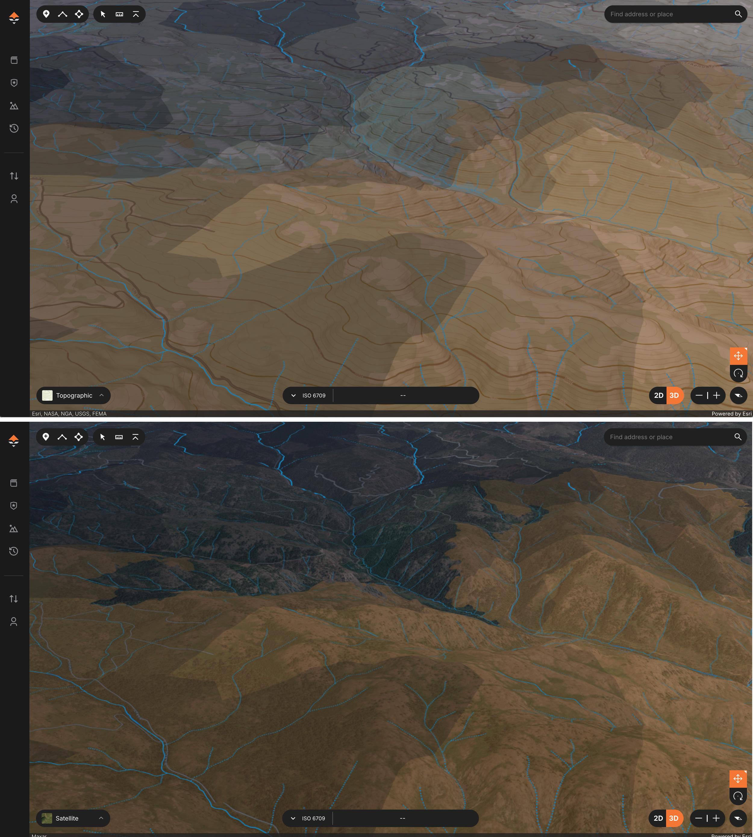
Example two:
In the same area, in the upper image, I have the Road Density layer stacked with the public land layer, and a wildfire layer overlaid on a topographic map. Then, in the lower image, I have the Road Density layer, stacked with public land, and a wildfire layer, overlaid on top of a satellite basemap. Both examples are also in 3D.
Example three:
Here is the same area, with basically no layers. Could you tell that this area was one that was worth checking out, just based on the satellite imagery? Maybe, but the Road Density layer and stacking other layers really painted a picture.
By combining these layers, you’ll discover overlooked basins, benches, and timber patches that most people might not think about looking at.
Planning an over-the-counter elk hunt? Don’t waste time hunting near the same roads as everyone else. Use the Road Density layer to quickly compare units and identify which units have better potential for areas with less road density. Or if you really want to hunt a particular unit for over-the-counter elk, use the Road Density layer to hunt this unit smarter than other people. Then, pair it with our Public/Private Land Layer and Trail Layers, and now you’re really cooking with gas.
I talk a lot about barriers to entry when it comes to e-scouting, and places that typically don’t have my roads in them are places that some hunters would rather not spend their time hunting. This is where the Road Density layer shines!
Looking to find a unit to apply for, and you want a certain type of hunting experience away from the crowds? The Road Density layer could be used during the application season to weed out units that might not be worth applying to based on road density.
Remember, not all roads are bad, and knowing where they are is critical to using them to your advantage. There are plenty of great bucks and bulls living in areas with high road densities.
So, with all that being said, don’t forget that the middle-ground road-density areas could be the secret sauce in your e-scouting.
What I mean by that is don’t overlook areas that might be in a slightly higher road density, as you’ll have people willing to go in really far away from the roads, and then you’ll have your typical road hunters. And what does that leave? The middle areas could go untouched.
The Road Density layer from GOHUNT is like turning on the lights in a dark room. It shows you where not to hunt, so you can focus on where you should.
In my own e-scouting, it’s become an essential tool for every western hunt I plan—whether it’s a coveted dream hunt, or my usual easy-to-draw grind type hunts. This isn’t just tech for tech’s sake. It’s a smarter way to plan a hunt, and it’s available on GOHUNT Maps.
Get out there, scout smart, and find the places everyone else overlooked.
Insider makes it easy to find tag opportunities by state, species, probability of draw odds success, and much more! Whether you have 0 points, max points, or any number of points for specific states, Insider gives you the information you need to plan a successful hunt. In addition to our research tools, all Insiders have access to GOHUNT Maps on the web and mobile app. We recognize that not everyone has access to their computer when they need to research for a hunt, so our research tools are also available through our mobile app. We have the only complete set of research/hunting tools to help you find the hunt you want this year or to help you plan for hunts in the future.
If you're unfamiliar with Insider, you can learn more below.
Dark black = lots of roads
Medium grey = fair number of roads
Light grey = lower number of roads
Areas that are clear = little to no roads


